Virtualization of the drenched POOMPUHAR Port utilizing bathymetric data processing
DOI:
https://doi.org/10.53555/sfs.v10i1.999Keywords:
Multi beam Echo Sounders, Bathymetry, Interpolation, Inversed Distance Weighting (IDW), ArcGIS.Abstract
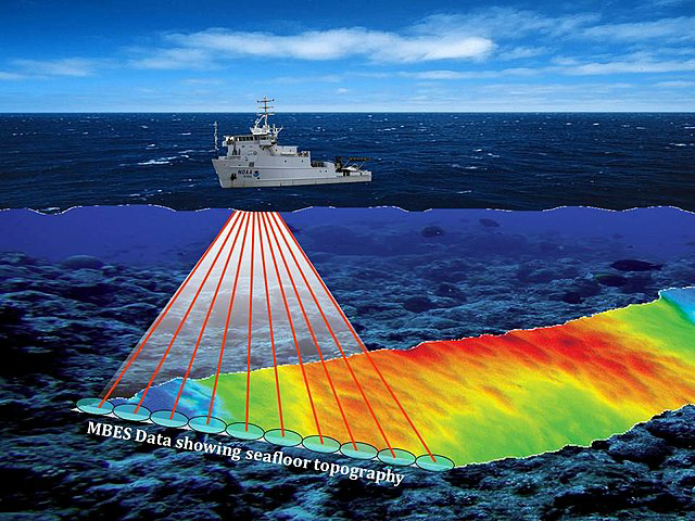
Marine archaeologists have unearthed Poompuhar, an ancient city, and harbor from the 4th century BCE that was situated in the Mayiladathurai District of Tamil Nadu, a southern Indian state. During the early Chola Kingdom's control, it was a well-established historical and ancient port that emerged with the growing oceangoing trade. This historic city and harbor serve as a metaphor for Tamil Nadu State civilization in the early 20th century. Then, in the year 500 AD, large shore waves swept this city away and destroyed it. These ancient cities and port ruins are still submerged and dispersed around the ocean's deep bottom. In reality, thorough examination and recreation of the life histories of harbour cities like Poompuhar are required to unearth several hidden virtues from the past. High-quality bathymetric data of the ocean floor have been gathered using multi-beam echo sounders. The primary results of the work are the precise identification and geo-tagging of the study region, the processing of the raw bathymetric data, and the thorough removal of undesirable signals. Here we have the interpolation method, which is important in creating bathymetric maps. Inversed Distance Weighting (IDW), one of several interpolation methods that are built into a GIS program, is used to create a bathymetric map based on the input processed bathymetric data. Later, the interpolated surface can be used to create a digital elevation model. The primary topic of this work is IDW, which focuses on a spatial and 3D interpolation approach to map the seabed using the provided input data. As a result, the IDW interpolation technique can be used to detect any submerged terrain anywhere in the world.


